
South Chilcotin Overland - Hurley River FSR and Lillooet Pioneer Road
- biegandrew
- Jul 5, 2023
- 4 min read
Updated: Jan 13, 2024
- Type: Classic Overland
- Rating: 4/5
- Season: Summer
- Length: 233km
- Vehicle suitability: Stock 4x4 or Subaru with AT tires

The Route
The South Chilcotin - Hurley River FSR and Lillooet Pioneer Road overland route begins and ends in Pemberton, British Columbia. This route can be traveled in a clockwise or counterclockwise manner, although we recommend completing it clockwise for the ease of pulling off at various viewpoints and recommended campsites. While portions of this route are on paved roads, this route epitomizes the mantra that overlanding is about the journey and not the destination as world-class views abound throughout this route.
From Pemberton, proceed north on Pemberton Meadows Road for approximately 24km’s until you reach Upper Lillooet FSR at GPS coordinates 50.48952, -122.97063. Turn right onto Upper Lillooet FSR, where the gravel road portion of this route begins. Proceed along the Upper Lillooet FSR for approximately 9km’s until GPS coordinates 50.53275, -123.04975, whereupon you will bear right onto the Hurley River FSR. This turnoff is well marked and for the duration of the 51km’s on the Hurley River FSR the road is obvious to follow.
While the Hurley River FSR has become somewhat notorious for having sharp gravel that results in punctured tires, in the multitude of times we have driven this road with all terrain tires we have never had a puncture. If you are not running all terrain or similarly appropriate tires, be sure to bring a tire patch kit and a spare tire. For an up to date status of the Hurley River FSR condition, https://isurvivedthehurley.com/ is the best resource.
Once on the Hurley River FSR, consider taking time to hike to Tenquille Lake via branch 12, found at GPS coordinates 50.55605, -123.02117 or Sephamore Lake at GPS coordinates 50.59020, -123.01821. Both of these hikes are relatively easy and have wonderful backcountry camping opportunities. While Sephamore Lake continues to increase in popularity, the abundance of alpine lakes in the vicinity of Sephamore Lake ensures that even on summer long weekends you will likely be able to find a private lake.


While traveling along the Hurley River FSR there are a number of adequate campsites just off the road; however, we recommend you continue as amazing campsites await at the end of the Hurley River FSR.


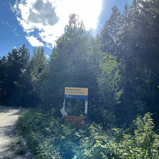
The first of our recommended sites can be found by taking a left turn onto Bridge River FSR at GPS coordinates 50.82351, -122.84685, approximately 4.5km from the end of the Hurley River FSR and the town of Gold Bridge. Once on Bridge River FSR, continue for approximately 9km’s until GPS coordinates 50.82602, -122.96054. Once at the above coordinates, take a right onto the overgrown logging road leading down to Downtown Lake. While this track appears to receive little use, it is in excellent condition and can be traveled by any 4x4 as long as pin-striping is not a concern.


If you choose to drive Bridge River FSR, it is strongly recommended that you have a radio and call-out as you drive up this FSR. There is significant active logging on this road and nearly every corner is blind with little room to maneuver should you encounter a loaded logging truck proceeding the opposing direction. If this sounds too stressful for you, fear not as there is another amazing site just past the town of Gold Bridge.
After having spent the night on Bridge River FSR, or having avoided this site altogether, return to the Hurley River FSR and continue north to the town of Gold Bridge. Gold Bridge is worth a short detour to check out this former thriving mining town. Gold Bridge also presents the opportunity to top up on gas (at prices cheaper than in Pemberton as of July 1, 2023).

After having checked out the town of Gold Bridge, continue onto the main road heading north east (Lillooet Pioneer Road). Approximately 8.7km’s along Lillooet Pioneer Road at GPS coordinates 50.89504, -122.77357, you will see a turn off for Gun Creek Recreation Site. This is a BC Hydro Recreation Site and is free to use; however, better camping can be found by taking the left most road at this turn off towards the Old Minto Townsite.

Taking the road to Old Minto Townsite you will quickly find yourself with expansive views east along Carpenter Lake. Unofficial roads crisscross the dry lake bed area directly ahead and to your right, allowing for 4x4 exploration and presenting significant camping opportunities. Much of this ground is of a clay-like substance and caution should be exercised if there has been recent heavy rain or heavy rain is expected. With dry conditions, we have seen full-size pickups with truck campers easily navigate across portions of this lake bed.


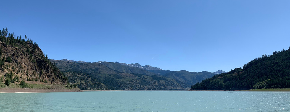


If time permits, consider spending several nights in this area as logging roads and hiking opportunities abound. Once you are ready to continue onwards, return to the Lillooet Pioneer Road and proceed east. This portion of the road follows Carpenter Lake for the entirety of its length. There are several large pullouts, which allow one to gain access to Carpenter Lake for a short walk or lunch break. While much of the Lillooet Pioneer Road is paved, there are gravel portions and reduced speed is recommended.


As you reach the end of Carpenter Lake, the landscape slowly begins to change. Drier conditions persist and you are greeted with sweeping views and Ponderosa Pines. As before, Lillooet Pioneer Road switches between paved and gravel at seemingly random intervals. Much of the upcoming section has significant drop offs and again, reduced speed is recommended. Take your time and enjoy the drive.


Eventually you will reach the town of Lillooet. Lillooet is significantly larger than Gold Bridge and accordingly has more amenities (Tim Hortons, gas, groceries, etc.). Leaving Lillooet, follow signs for highway 99 and/or Pemberton. This will take you onto the final portion of this route, along the famous Duffey Lake Road. This road is incredibly scenic and is paved for its entirety. There are ample opportunities for easy day hikes along this road, including the much-hyped Joffre Lakes and the equally beautiful though less popular Rohr Lake. There are also many Recreational Sites that can be found on this section; however, all that we have visited appear are overly popular and shaded due to the surrounding canyon walls.

After completing or bypassing these hikes, continue traveling west along Duffey Lake Road until you reach the conclusion of this route back at Pemberton. If you have more time, consider completing the overland route from Pemberton to Harrison Hot Springs along the In-SHUCK-ch FSR (detailed in reverse here)!