
Peachland to Merritt Overland – Various FSR’s
- biegandrew
- Aug 24, 2023
- 5 min read
Summary of Route
- Type: Classic Overland
- Rating: 4/5
- Season: Any, but Spring to October recommended
- Length: 156 km’s one way
- Vehicle suitability: Stock 4x4 or Subaru with AT tires.


The Route
Comprising over 150 km’s of gravel travel with excellent campsites spread throughout, the Peachland to Merritt Overland route is beginner friendly and a 4x4 is not required.
Starting from the town of Peachland, British Columbia, head west on Princeton Avenue (GPS coordinates 49.77021; -119.74144). You will travel on Princeton Avenue for approximately 21.3km’s until turning left, following signs for Peachland Lake (GPS coordinates 49.85517, -119.96304). The road will turn to gravel at this point and, aside from a small connector portion on and after highway 5A, remain gravel for the remainder of this trip.


Within 2km’s of travel you will encounter an intersection. Bear left/straight through to reach the first campsite on this route: Peachland Lake. This site is wide open and gets excellent sun-exposure; however, on busy weekends this also means that there will be little privacy between sites. If the main recreation site is too busy for your liking, consider exploring the north shore of Peachland Lake for additional dispersed camping sites. If you have completed the drive from Vancouver to Peachland to start this route, Peachland Lake is an excellent first stop. If you are passing this site, bear right to continue.


This next section is the most difficult of the entire Peachland to Merritt Overland route. That being said, any vehicle with more than the most basic clearance should be able to pass through without too much difficulty. After approximately 3.1km’s of slow going, you will encounter another well-groomed FSR. Turn left, following signs for Headwaters Lake. Several adequate campsites can be found in this area; however, the ones at Peachland Lake are more enjoyable. After travelling 0.5 km’s, you will reach another major intersection (GPS coordinates: 49.82755, -199.99880). Take a right turn to continue on Peachland FSR. More campsites can be found in the immediate vicinity of this intersection; however, as you continue to travel west along Peachland FSR you will shortly be passing private property.


Continue traveling west along Peachland FSR. In 7.1 km’s you will reach a small intersection (GPS coordinates: 49.81194, -120.07438). Bear left for Crescent Lake recreation site. This recreation site is very small with only 2 worthwhile sites; however, it is beautiful should you be lucky enough to snag one of those sites.


Approximately 1.4 km’s after passing the intersection for Crescent Lake you will encounter another more obvious intersection. Bear left, staying on the main road. Continue on this main road for an additional 9.6km’s, avoiding all off-shoots including Whitehead Lake FSR. The turnoff for the Whitehead Lake recreation site will be the intersection immediately following the Whitehead Lake FSR turnoff. Whitehead Lake recreation site has several sites that are well spaced out. Unfortunately, only one of these sites appears to receive much sun exposure and was occupied when we explored this area on a sunny weekday in August. Access to the Whitehead Lake recreation site is slightly rougher and those uncertain of their vehicles capability may wish to avoid this site.


After visiting or avoiding Whitehead Lake recreation site, continue travelling west on the main road you have been on until this point. In approximately 3 km’s of travel you will reach another intersection (GPS coordinates 49.79743; -120.22274), bear right avoiding Sunday Lake Road.


Continue travelling for approximately 3.8 km’s until your next intersection (GPS coordinates: 49.80781; -120.26657). You will bear left, taking the road less travelled. While less travelled and narrower than the road’s you have predominately travelled thus far, this road is similarly in excellent condition.


Continue along this road for approximately 7.8 km’s until your next intersection where you will bear right. As you travel those 7.8 km’s, take your time to enjoy the views as you begin to drop in elevation. After an additional 2.7km’s of travel you will pass a road sign indicating “Galina Road”, confirming you are on the correct path. Bear right at your next intersection (GPS coordinates: 49.80169; -120.36382).


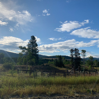
After approximately 7.3m km’s of travel you will encounter a small intersection. Bear left to enter Buck Lake recreation site, as depicted below. Should you miss this turnoff, a better turnoff with signage indicating Buck Lake recreation site can be found shortly ahead. Buck Lake is an excellent recreation site with adequately spaced out campsites. Due to its proximity to highway 97c, this site does fill up on weekends. If that is the case, explore the FSR directly north of Buck Lake for a few additional sites that can be utilized in a pinch.


As you leave Buck Lake recreation site, you will take your first left onto Dillard Galena FSR (GPS coordinates: 49.82654; -120.44365), leaving the more well maintained and travelled road. You will be travelling on Dillard Galena FSR for approximately 6.7 km’s until returning to a major FSR. Turn right onto this well defined FSR. You will see a sign indicating “Highway 5a 2km away”, confirming you are on the correct route.


Over the next 2.8 km’s you will begin to have peak-a-boo views of Missezula Lake. After travelling 2.8 km’s you will encounter the turn-off for Missezula Lake North recreation site. There are multiple adequate campsites at Missezula Lake North recreation site; however, the prime sites along the lakeshore are frequently occupied.


If you’re avoiding Missezula Lake North recreation site, continue travelling north west along the main FSR you have been travelling along. Road conditions remain excellent for the duration of the drive to highway 5A and views soon begin to open up.


As you reach highway 5A, fear not as this overland route is not finished yet! Proceed north (turning right) onto highway 5A. Travel approximately 6.2km’s on highway 5a, turning left to follow signs for Otter Lake (GPS coordinates: 49.88105; -120.62959).


Proceed along the paved Coalmont Road for 11.1 km’s, passing various historic buildings and ranchland. Following signs for Boss and Davis Lake, turn right at GPS coordinates 49.82169, -120.70026), leaving Voght Valley Road and returning to gravel travel for the remainder of this route.


If you are intending to camp for one final night on this trip, plan to find your site in the next 14.4 km’s as this area is littered with wonderful recreation sites that are all within easy access of a lake. In our time in this area we have checked out Davis Lake recreation site, Boss Lake recreation site, Tahla Lake recreation site, and Shea Lake recreation site. If you are looking for a more private site consider checking out GPS coordinates 49.85853; -120.72729, just before the main Davis Lake recreation site area. Additionally, Tahla Lake recreation site has a short (100m) walk-in site that is suitable for tent campers and allows you to be entirely detached from the main recreation site and have a view over Tahla Lake. All of the gravel intersections in this 14.4 km section lead to various recreation sites.


If you are not wanting to explore these sites, continue along the most well-maintained road. After having travelled 14.4 km’s, you will reach a major intersection (GPS coordinates: 49.91565; -120.79460). Turn right onto Kane Valley Road. Travel east on Kane Valley Road for approximately 2.4 km’s, then turn left onto Englishman Road. Englishman Road shortly changes into Kane Connector Road, confirming you are on the correct path. Continue along Kane Connect Road for approximately 8.7 km’s until you reach Gwen Lake Road. Turn right onto Gwen Lake Road.


After 1.9 km’s of travel on Gwen Lake Road you will encounter an intersection. Turn right to reach Gwen Lake recreation site. Access is slightly difficult and the site is very underwhelming. We recommend avoiding this site and continuing along Gwen Lake Road, reaching the Coquihalla Highway and the conclusion of this route in 5 km’s.


If your fuel levels and time considerations permit, consider tackling the second portion of our Great Southwest British Columbia Overland Route: Merritt – Boston Bar Overland. Detailed overland guide coming shortly.


