top of page


Skwellepil Creek Rec Site – Chehalis FSR
An easy overland route that culminates with beautiful camping options on the shore of Chehalis Lake. Very busy on weekends.


Squamish Valley Camping - Squamish Valley FSR
An easy overland route with wonderful beach camping and multiple points of interest throughout.


Chipmunk Caves and Foley Lake – Chilliwack Lake Road and Foley Creek FSR
An easy early season route featuring caves and lakeside camping.


Stoyoma Mountain and Cabin Lake – Inaccessible (updated: August, 2024)
Detailed report on routes to access Stoyoma Mountain and Cabin Lake. As of August 2024, bridges are washed out on all routes. INACCESSIBLE


Mount Thynne – Thynne Mountain FSR
A moderately challenging route that presents big views and sub-alpine lake camping opportunities. Highly recommended!


Gillis Lake to Murray Lake – Murray Lake FSR
An easy route with lakeside camping that is far enough from the lower mainland to avoid crowds yet still within easy access.


Murphy Lakes and Grasshopper Ridge – Tulameen and Lawless Grasshopper FSR’s
A relaxing, scenic route that provides camping opportunities at west Murphy Lake and adequate views from Grasshopper Ridge.


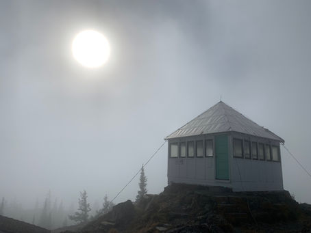
Greenstone Mountain Lookout – Greenstone Mountain Road
A relatively short, easy through route providing access to the retired Greenstone Mountain fire lookout.


Squamish to Indian Arm – Mamquam and Stawamus/Indian River FSR’s
An easy, relatively short route that provides access to an incredible oceanfront campsite located on the north end of Indian Arm.


Harrison to Pemberton Overland – Sts’ailes, Lillooet West and In-SHUCK FSR’s
Comprising 162 km's of gravel travel with excellent views, hot springs, and vehicle accessible camping on Harrison Lake and Lillooet Lake.


Peachland to Merritt Overland – Various FSR’s
Comprising 156km's of gravel travel, this route is an easy, immersive overland experience with boundless lakeshore camping opportunities.


The Road to Liumchen Lake – Windy Knob FSR
Only have a low clearance AWD vehicle? Looking for big views with low effort and a small time commitment? This route is for you!


Silver Peak – Silver Skagit Road
A challenging out and back route with abandoned mines, big views throughout, and a gorgeous alpine lake.


Upper Bridal Falls – Chipmunk FSR
A challenging route that is more "off-road" than overland. A treed in approach with beautiful views at the conclusion of the route.


Kafir Peak – D’Arcy/Micro FSR
An excellent relatively easy route that allows for access to an elevation of 1900m with big views and multiple camping opportunities.


Blowdown Pass – Blowdown FSR
A moderately challenging out and back overland route that presents alpine camping opportunities and reaches an elevation of 2,150m.


South Chilcotin Overland - Hurley River FSR and Lillooet Pioneer Road
Beginning and ending in Pemberton, BC, this route covers 233km of mixed paved and gravel travel with epic views throughout.


Hidden Cabin - Florence Lake FSR
An easy out and back route with points of interest at Rocky Point and Morgan Lake, including walk-in lakeshore camping and a hidden cabin.


Jones Lake (Wahleach Lake) – Jones Lake FSR
An easy out and back overland route with beach car camping. An abundance of absolutely stunning campsites if weekend crowds can be avoided.


Salsbury Lake and Grotto Falls – Lost Creek FSR
A moderately difficult out and back overland route with several vehicle accessible camping options.
bottom of page